
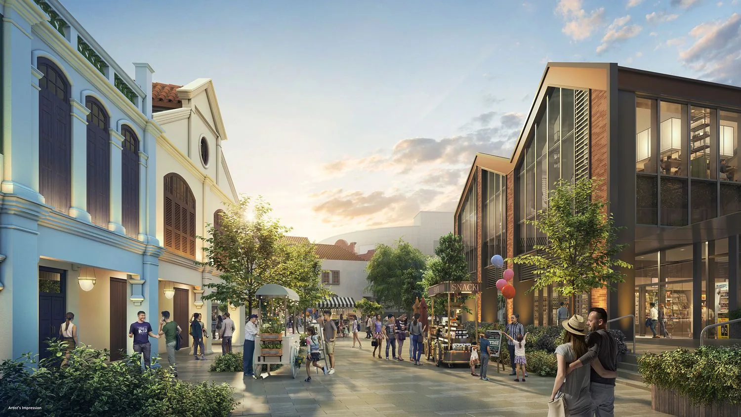
 Artist’s impression
Union Square Residences stands at 28 Havelock Road, District 1, between the Singapore River and Chinatown. Clarke Quay MRT station is about 380 metres away in a straight line, with Chinatown and Fort Canning stations both within about 500 metres.
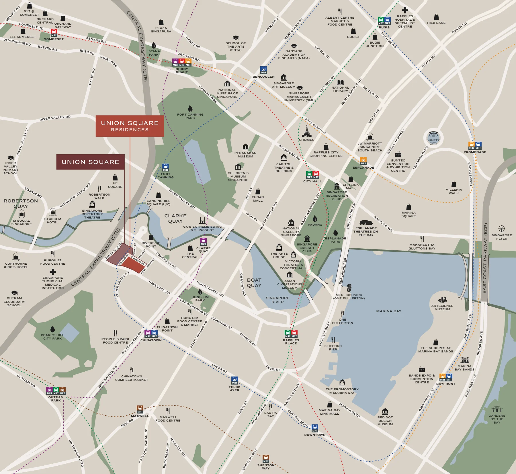
Union Square Residences Location Map
Map centred on Union Square Residences, 28 Havelock Road (1.28820, 103.84312). Open Union Square Residences in Google Maps.
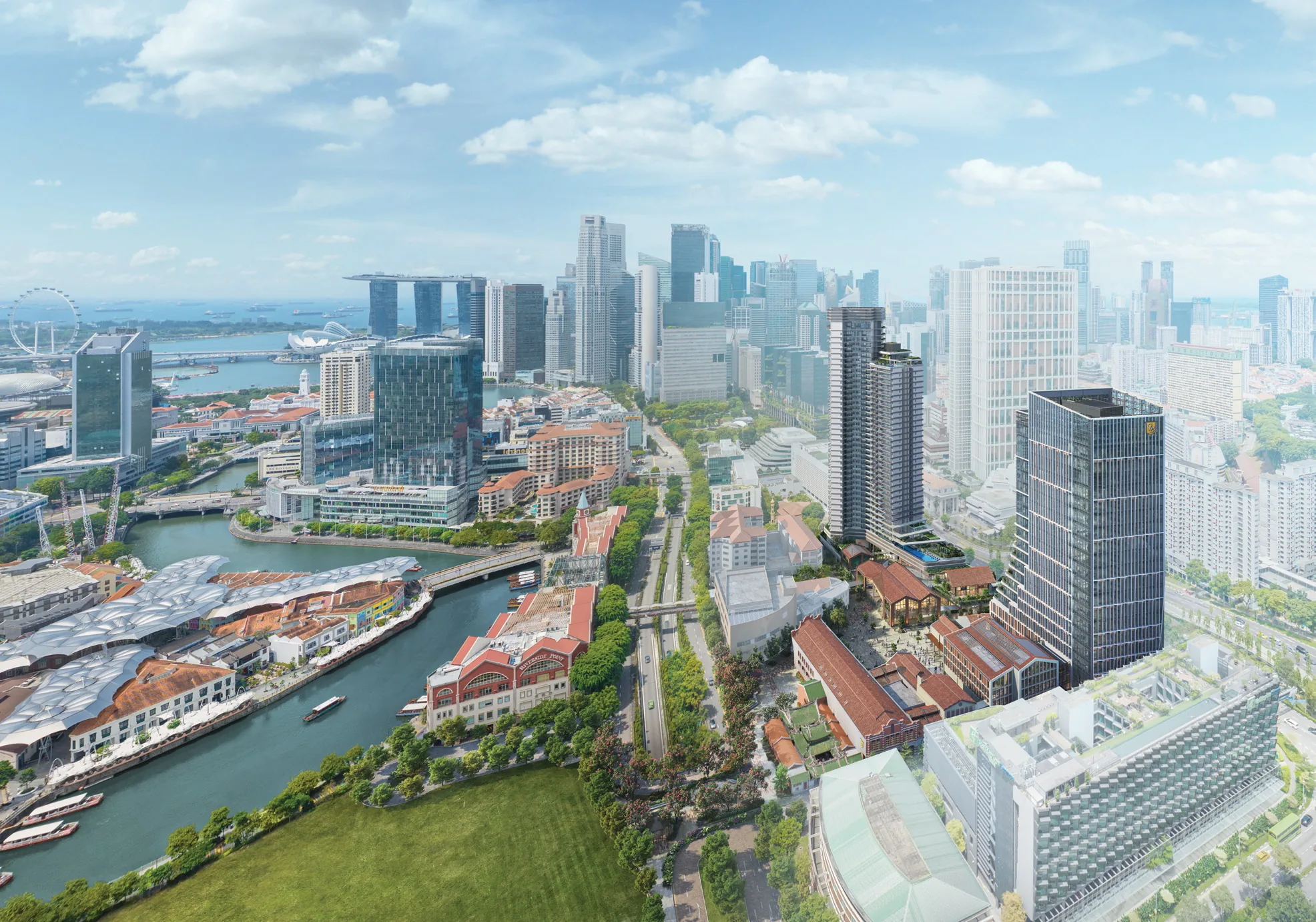
The Union Square site is bounded by Havelock Road to the south-west, Merchant Road to the north, Upper Cross Street to the east and Cumming Street to the west. Across Merchant Road lie Riverside Point and the river; across Upper Cross Street, Hong Lim Park and the edge of Chinatown; and to the west, the Havelock Road hotel belt towards Robertson Quay. A refurbished pedestrian bridge crosses Upper Cross Street, and a linkway leads to Clarke Quay and the Singapore River.
Union Square Residences Distances
The distances below are straight-line measurements from the site on OneMap; walking routes are longer. They show how much of the city centre lies within a short walk of Union Square Residences, from three MRT stations and the river to Chinatown, the museums and the financial district.
Within about 700 metres
| Destination | Straight-line distance |
|---|---|
| Riverside Point | about 170 m |
| Clarke Quay MRT station (NE5) | about 380 m |
| The Central / Clarke Quay Central | about 390 m |
| Chinatown Point | about 400 m |
| Canninghill Square (Clarke Quay) | about 410 m |
| Hong Lim Park | about 420 m |
| Clarke Quay | about 430 m |
| Hong Lim Food Centre | about 440 m |
| Robertson Walk | about 450 m |
| People’s Park Complex | about 460 m |
| Chinatown MRT station (NE4 / DT19) | about 470 m |
| Fort Canning MRT station (DT20) | about 490 m |
| Chinatown Heritage Centre | about 530 m |
| Pearl’s Hill City Park | about 640 m |
| Chinatown Complex | about 660 m |
| Outram Secondary School | about 690 m |
About 0.7 to 2.1 kilometres
| Destination | Straight-line distance |
|---|---|
| Boat Quay | about 690 m |
| Fort Canning Park | about 700 m |
| Funan | about 840 m |
| Maxwell MRT station (TE18) | about 860 m |
| Outram Park MRT station (EW16) | about 880 m |
| Asian Civilisations Museum | about 920 m |
| National Gallery Singapore | about 990 m |
| Raffles Place MRT station | about 1.0 km |
| Havelock MRT station (TE16) | about 1.06 km |
| Singapore General Hospital | about 1.27 km |
| Tiong Bahru Market | about 1.27 km |
| Raffles City Shopping Centre | about 1.28 km |
| Great World | about 1.36 km |
| Marina Bay Sands | about 1.9 km |
| ION Orchard | about 2.1 km |
Measured on OneMap (SLA) from the site pin. School distances should be confirmed with the MOE SchoolFinder.
The neighbourhood around Union Square Residences
Union Square sits where four districts touch: the river and its quays to the north, Chinatown to the south, the civic and museum district to the east and the CBD beyond it. That mix is what the developer’s brochure calls a crossroads, and it means that most daily needs, from groceries and hawker food to the office and the theatre, are within walking distance.
Five area guides look further: Clarke Quay and the river, Chinatown, the three MRT stations, Fort Canning and Pearl’s Hill and schools nearby.
Request the Union Square Residences Price List
Union Square Residences is on sale, and the Sales Concierge sends the current price list with the homes still available by stack. Showflat viewings are arranged by appointment through the Sales Concierge.
Sent on request
- The current price list with the available units by stack.
- The e-brochure and every floor plan, from 463 to 4,833 sq ft.
- The elevation chart, placing each home in the 40-storey tower.
- A worked payment schedule and the stamp duty for your profile.
- A showflat appointment arranged around your diary.
Request the Price List
No obligation. The Sales Concierge responds personally to every enquiry.
Prefer to speak to someone? Call +65 6200 6220, or send a WhatsApp message to the same number.